My First Solo Trip: 4 Days in California
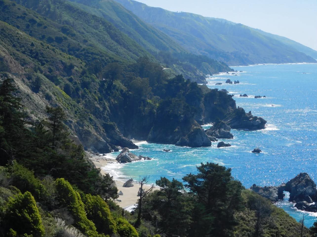
Trip at a Glance
- Length: 4 days
- Total cost: Approximately $1,000
- Travel style: Solo
- Transportation: Rental car
- Route: San Francisco → Big Sur → Monterey/Carmel → San Jose → San Francisco
I’m quite the impulsive traveler. The kind who books a trip one month before the flight’s departure and lets the rest fall into place.
Working in college athletics, time away is coveted. That means I plan around university breaks and the occasional PTO-friendly long weekend.
That’s what happened with my trip to Big Sur. Spring break was fast approaching, and I wanted to go somewhere. Anywhere that I could make the most of my limited time and budget.
So I planned the entire trip during a work trip to Florida State University with the tennis team, watching them practice for a match while I booked flights and hotels less than 30 days in advance.
Four days. San Francisco. San Jose. And best of all, Big Sur.
Did I change my mind along the way about the things I wanted to see and the things I wanted to skip?
Absolutely.
Was I nervous to go on my first-ever solo trip?
100%.
Here’s what I did, what I saved and splurged on, what I loved, and what I would do differently next time.
Day 1: Austin to San Francisco
Living in College Station, I’ve found that some of the best and cheapest flights are out of Austin-Bergstrom International Airport, about 100 miles away.
So naturally, my day began with driving to Austin at 1 a.m. for a 5 a.m. departure to San Francisco.
With a short layover in Dallas Love Field, I made it to San Francisco at 9:30 a.m. on Friday, March 6.
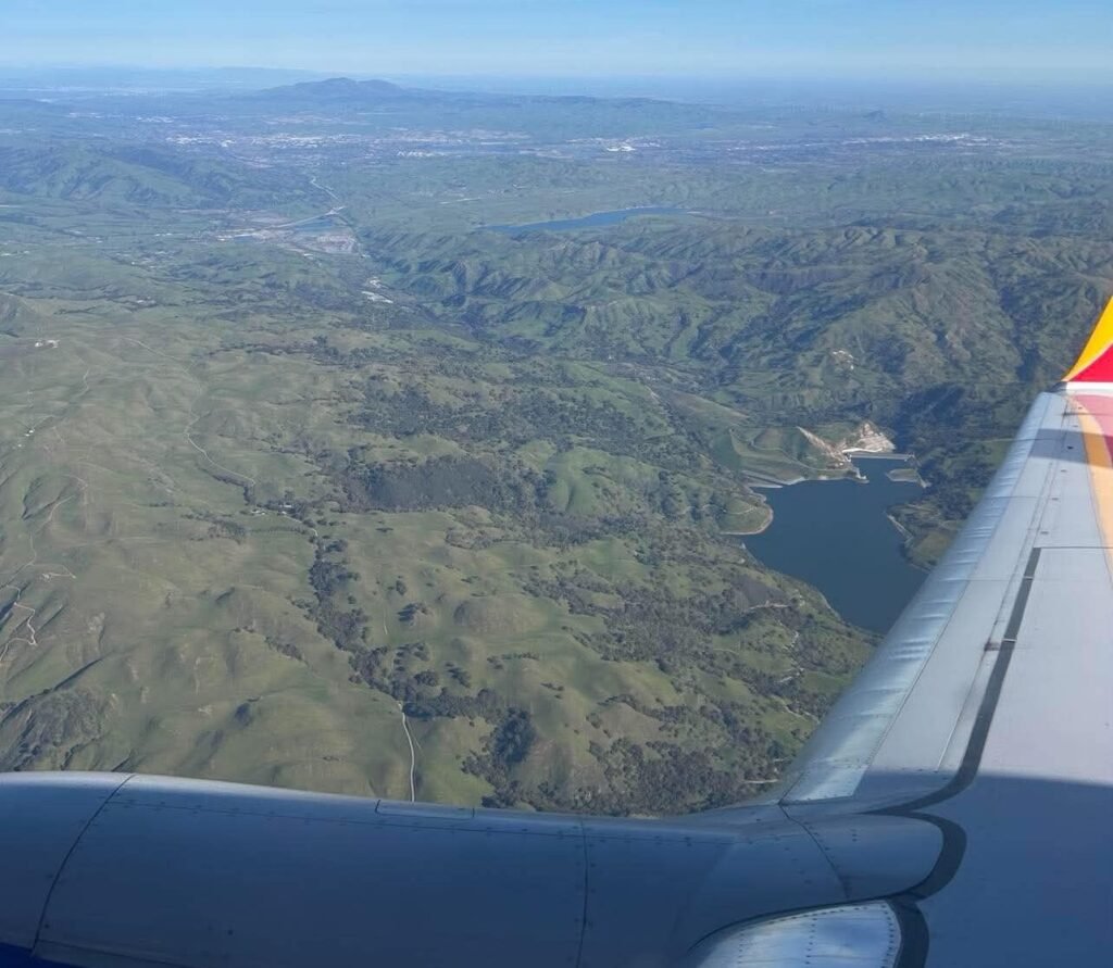
The flight was an economy, carry-on-only fare with Southwest Airlines and cost $194. I was able to check my bag at the gate for free, which was a nice bonus.
Personally, I never check a bag. Between my duffel bag and backpack, I have more than enough room, since narrowing down outfits is an area for improvement for me.
For a four-day trip, I try to bring only two to three pairs of shoes to lighten my load: hiking boots, a casual shoe, and sandals.
I also always travel with my hiking boots and pack my lighter shoes in my backpack, which gives me even more room in my duffel bag.
However, since I unexpectedly checked my bag at the gate, I had to wait for it in baggage claim, which took a lot longer than I had hoped.
At that point I was regretting my decision to check my bag since this set my personally imposed timetable back.
Like I said, I like to make the absolute most out of my trips in hopes of seeing everything in such a short time frame, so I had a pretty ambitious first-day itinerary.
Honestly, I had a pretty ambitious four-day itinerary.
I also didn’t realize that the rental car facilities weren’t on site at the airport and that I would have to take the AirTrain to Avis Rental.
As much research as I do into activities and mapping out where I want to go, I actually go into trips pretty blind when it comes to the logistics. I like to fly by the seat of my pants a little.
Still, I made it to Avis and picked up my car. I always use Avis because I get a discount through my job, so four days with a rental car cost me roughly $240.
The nice lady at the counter even upgraded me to a Volkswagen Jetta once I mentioned I planned to go to Big Sur.
I also happened to run into a professional hockey team arriving for a game at the rental car facility, which made my day.
I had recently gotten into hockey, and it was actually one of the reasons I chose Northern California for this trip.
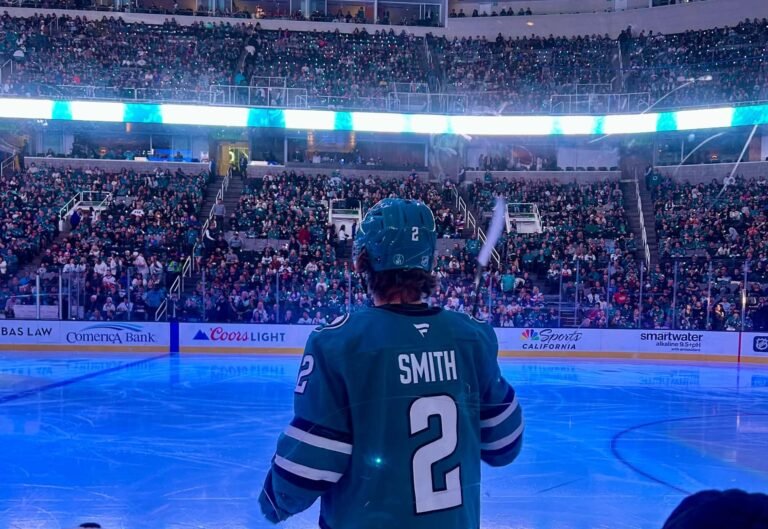
I had already bought a ticket to see the Sharks, so running into a team before I had even made it out of the airport felt like a pretty good start to the trip.
At this point, it was nearly 11 a.m., so I started the drive to Big Sur. The goal was to hit Point Lobos State Natural Reserve at the edge of Big Sur, the 17-Mile Drive for sunset, and dinner somewhere in Monterey.
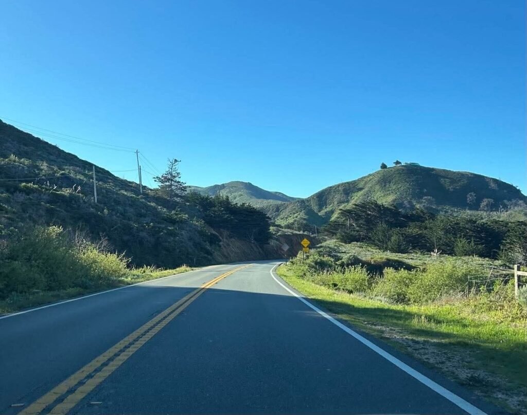
The drive down was easy and took about two hours, considering I did stop for a quick McDonald’s drive-thru moment.
Usually, I only like to eat locally on trips, but I was in a rush since my schedule had been pushed back.
Still, I made it to Point Lobos State Natural Reserve around 1:00-1:30 p.m. and promptly checked in with my mother.
If you’re anything like me, my mother will be getting a play-by-play rundown of the whole trip.
As a solo female traveler, I think it’s important to make sure someone knows where you’re going and has a general idea of your itinerary, especially when you’re traveling to places like Big Sur where cell service can be spotty or nonexistent.
My mom knew my plans for the day and where I expected to be, which gave us both a little more peace of mind.
Point Lobos State Natural Reserve is a popular attraction in the area, and parking is limited within the reserve. Once the lot is full, the entrance is closed to vehicles, but you can still walk in and access the trails.
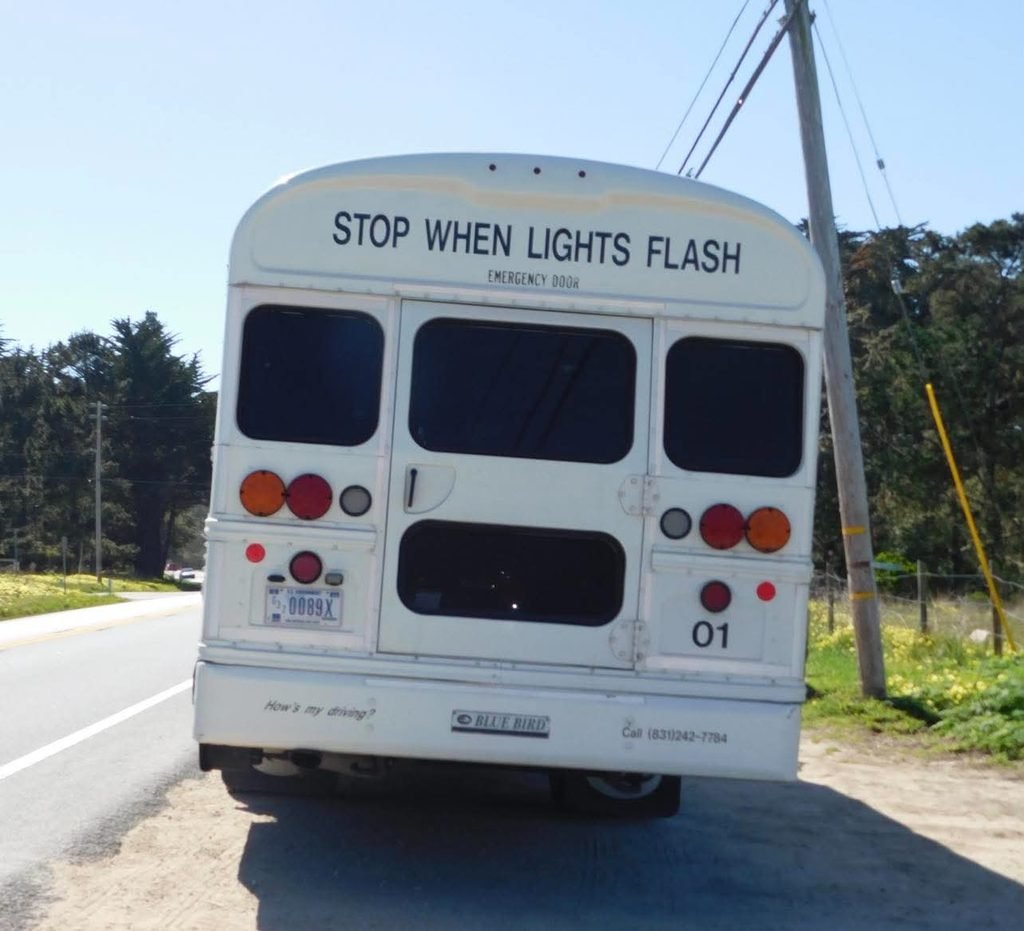
Parking in the reserve costs $10 per vehicle, but since the parking lots were closed when I arrived in the afternoon, I was able to park along Highway 1 and walk in for free.
I would highly suggest getting to the reserve as early as possible, or after 3 p.m., if you want to secure parking and be able to drive around within the reserve.
It ended up being a long afternoon of exploring on foot for me.
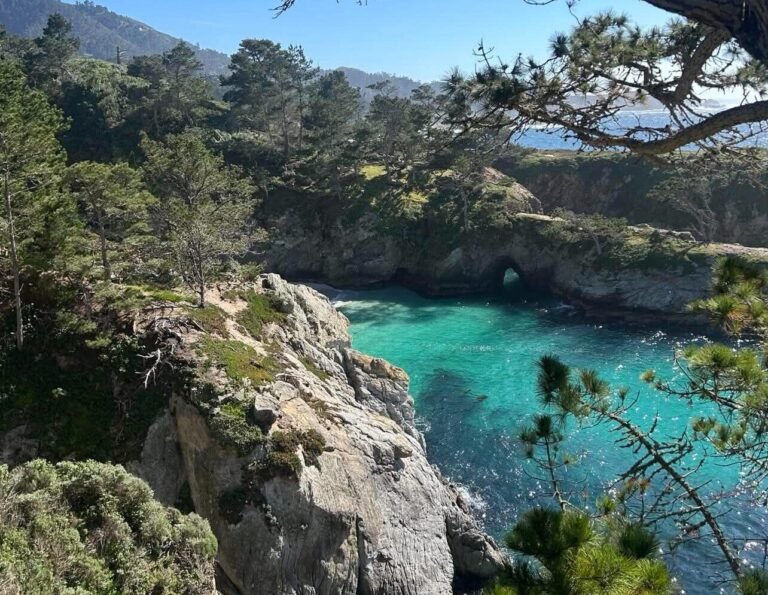
Once I got into the reserve, I knew I wanted to see two places: China Cove and Cypress Grove.
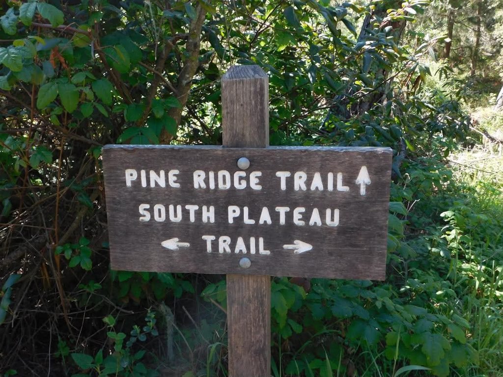
When you walk in, you can purchase a physical map for two dollars or utilize a free, downloaded map from online resources.
I decided to just follow the trail the volunteers suggested and see where I ended up along the way.
I was also told that hitting both spots on foot would take roughly four to five hours if I walked the full trail. I
definitely did not have that kind of time if I wanted to make it to the beach for sunset, but like I said, I was ambitious.
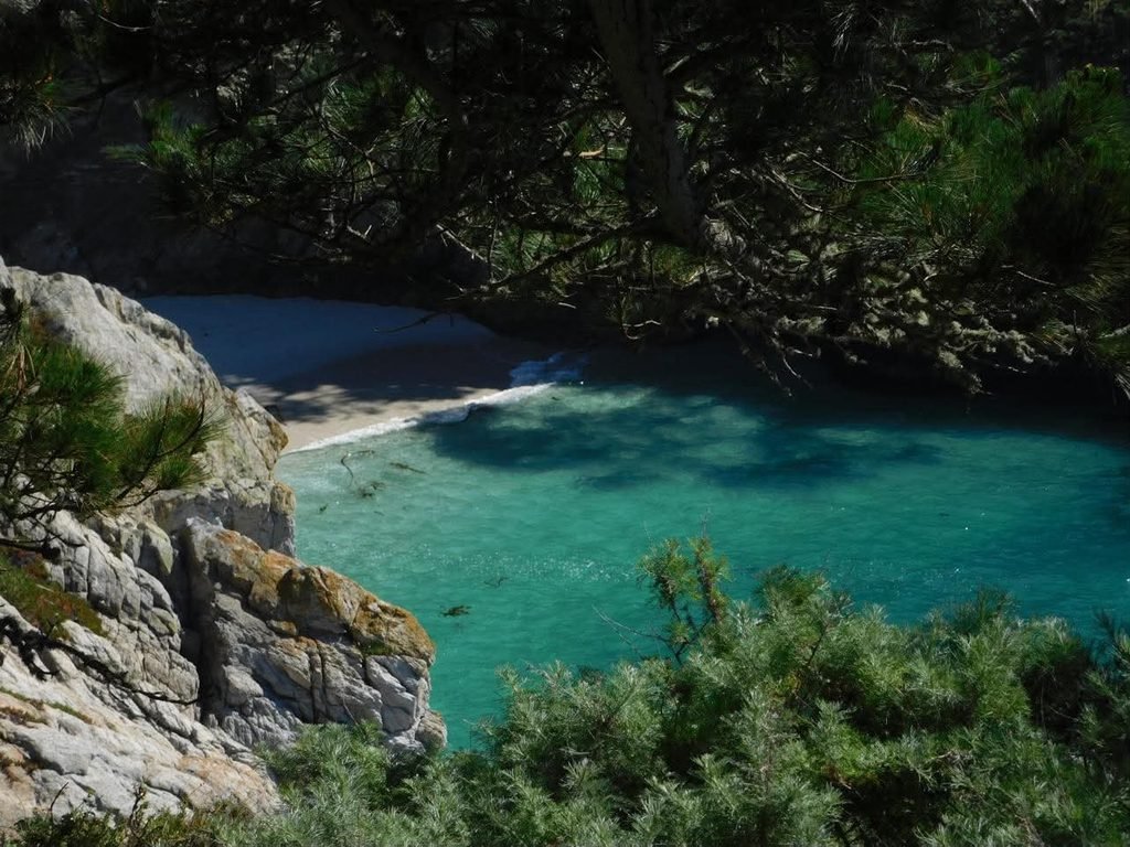
I started on the South Plateau Trail near the entrance, which took me to Gibson Beach.
You can take stairs all the way down to the beach, but the steepness of the descent and the climb back up gave me pause.
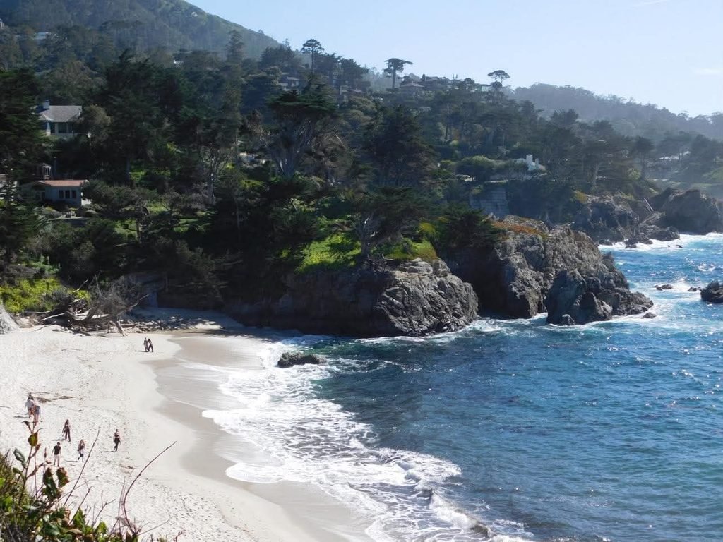
Gibson Beach was honestly the highlight of the reserve for me since it was the first place I saw, and it gave me a glimpse of Carmel Highlands, home to some of the most expensive real estate in California.
This little tidbit came from the GuideAlong Big Sur, PCH Highway 1 audio tour. I genuinely swear by these audio tours as someone who can go into trips without a solid plan.
I used one during my trip to Yellowstone and Grand Teton last year, and it completely leveled up the experience.
They’re especially useful in places where you have little or no cell service because you can download the map and tour ahead of time. It’s also affordable at $16.99 for the audio tour.
I used it along my hike on the Point Lobos trail, stopping at places like China Cove, Bird Island, and Sea Lion Point. I also was able to see multiple types of birds, sea lions, and deer throughout the trail.
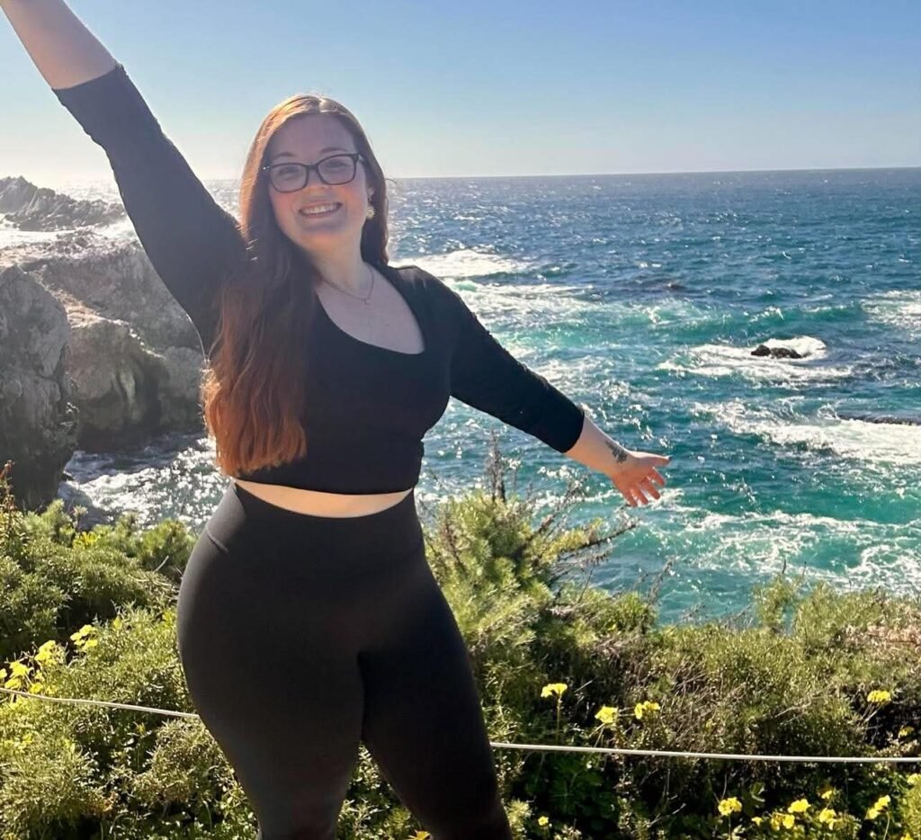
Along the way, I stopped for pictures. Besides the experience itself, photography is one of the main reasons I take these trips. All photos in this story were taken by my 2015 Nikon camera or iPhone.
One of the best investments I’ve made as a solo female traveler is an adjustable, portable tripod that I carry in my backpack.
It has a Bluetooth button that allows me to take pictures of myself without having to ask someone else, although people are kind enough to stop and help sometimes.
I never feel pressured to hurry up and get the shot because I’ve asked a stranger to take my picture. I can take my time and take 50 pictures with a slightly different angle each time to get the perfect shot.
By the time I finished this loop and headed toward Cypress Grove, it was nearing 4 p.m., so I made the executive decision to pass on the last attraction and head back to my hotel to get ready for sunset.
If I had more time, I absolutely would have stuck around to finish out the 0.8-mile loop.
It was absolutely for the best because I immediately hit traffic heading back toward Monterey.
This started to stress me out a little because it turned what should have been a twenty-minute drive into an hour-long crawl.
Thankfully, I made it to my hotel, Motel 6 Marina. While it was a clean and budget-friendly option, I did slightly regret my decision as a solo traveler.
Outward-facing motels freak me out a little anyways, but it didn’t help that I had to walk a distance from the parking lot to my room on the inner side of the motel.
I also had some issues checking in because they had accidentally confused me with another traveler. Apparently, we had identical driver’s license numbers, just from different states.
I quickly changed once I got into my room and headed toward the 17-Mile Drive.
There are multiple entrances for the drive, but I chose the Carmel Entrance. This is the southernmost entrance which takes you back north towards Monterey.
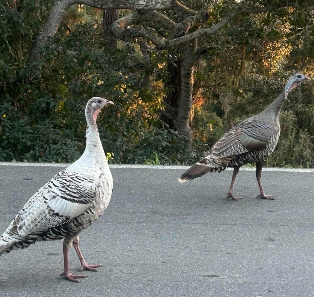
Right after the gate, some turkeys were hanging out on the road so be cautious of wildlife along the route.
The entrance fee for the drive is $12.50 per vehicle, and they also give you a map. You can also get a free PDF version of the map on Pebble Beach’s website to help plan your stops.
While there is a GuideAlong audio tour for the drive, it is separate from the Big Sur one I had purchased, and I did not want to pay another seventeen dollars when I had a perfectly good map in hand.
However, I immediately missed my turn as soon as I got past the gate. A quick U-turn and taking a minute to get my barrings together was all I needed to figure out my plan of action.
First on the agenda was the Lone Cypress which was about a ten minute drive.
The sun was setting by the time I made it to the vista point, and it was an unbelievable sunset. Watching it dip over the horizon will forever be a core memory for me.
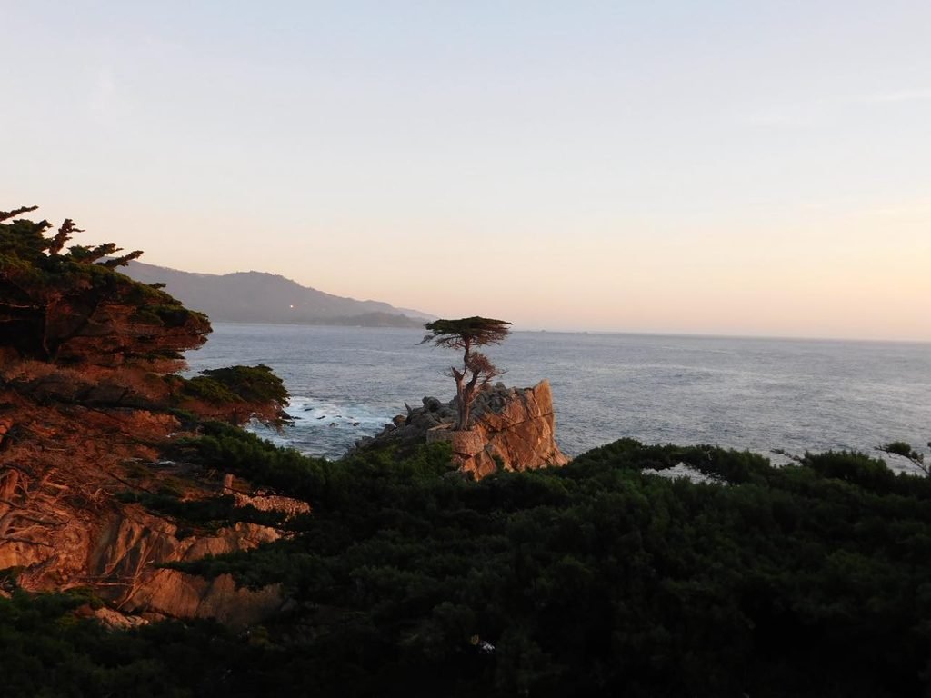
With dusk starting to set in, I made my way down to a parking lot near Point Joe. This is where I was able to set up my tripod and get some photos with the sunset.
That was the whole point of going on the 17-Mile Drive on my first day, so I didn’t take my time exploring the stops yet.
After this, I realized that I had hardly eaten the entire day since McDonald’s had messed up my order earlier.
It had been a long day, and I was definitely feeling the effects at this point. I just wanted food and to go to bed.
So I stopped at Gianni’s Pizza after a hopeful TikTok search, and I’m not sure if I was just hungry or if this place was actually God-sent. I had a jumbo cheese ravioli, garlic bread, and a crisp Coke.
I find myself often wanting to book another trip for the ravioli alone.
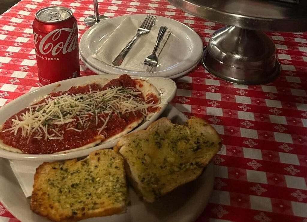
The meal cost around $30 after I decided to also try their cookie dough gelato, which I ate in silence in my car afterward, so exhausted that I almost felt buzzed.
At the hotel, I did feel a little uncomfortable walking from the parking lot to my room in the dark. You do have to park on the outside of the building and walk into a courtyard to access stairs.
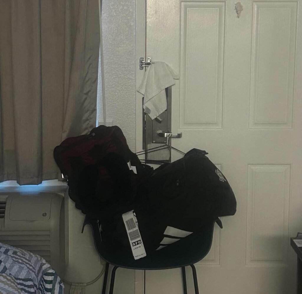
Before this solo trip, I had researched some different ways to make myself feel safer and ended up putting a chair against the door with my luggage weighing it down and a hanger on the door handle. That way, if the door moved, I would hear it.
I don’t do this when I stay in more established lodging, but it gave me some extra peace of mind that night.
Day 2: Big Sur & San Jose
I woke up at 6 a.m. and got ready for the day, checking out of my hotel and heading over to the nearby gas station to stock up on water and snacks.
I also needed to fill up the tank, which ended up being a larger expense than I had originally planned.
That first weekend in March was when gas prices surged across the country, but thankfully, the car I reserved was relatively fuel-efficient.
For solo trips, my rule around gas is to fill up when I get to approximately half a tank, just to make sure I have some wiggle room.
This is especially true when I’m headed somewhere with spotty cell service.
With light traffic that Saturday morning, I pulled over at my first spontaneous scenic stop in Big Sur.
While I like having a general outline of key sights, I always leave plenty of room to pause whenever a view catches my eye.
This stop was near the California Sea Otter Game Refuge. You can park right off the road and walk out to a wooden platform offering dramatic views of the coastline.
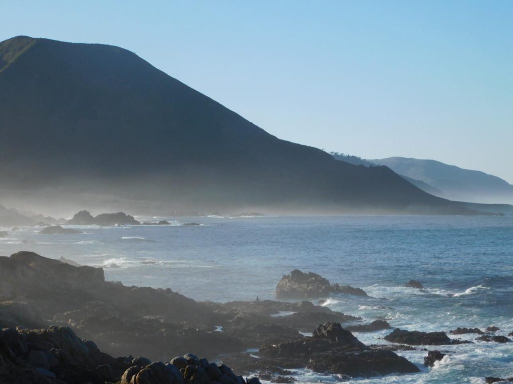
Around 7:45 a.m., heavy fog still clung to the jagged cliffs, giving the whole landscape a beautiful moody vibe. It made for an incredible photo op and let me snag some unique shots of fishermen working along the rocky shore below.
After this quick stop, I made my way over to Garrapata State Park.
This state park has about two miles of ocean side trails and access to its own beach. There is also an inland hike that I didn’t have time to explore.
I specifically planned to stop here because I wanted to visit Calla Lily Valley, one of the first pull-offs in the park (Gate 18).
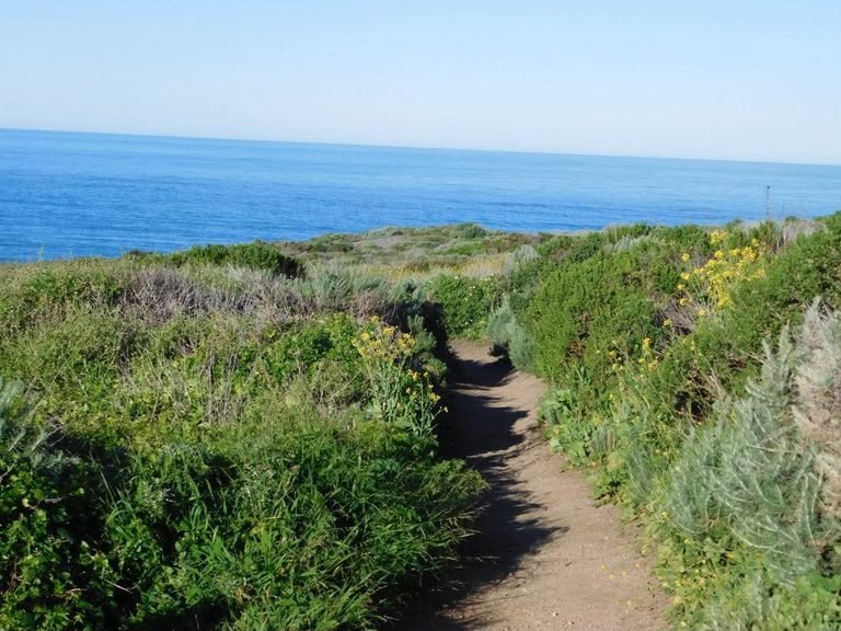
The trail is clearly marked, but I would warn that there is some overgrown greenery and poison oak, so wearing long pants is a must.
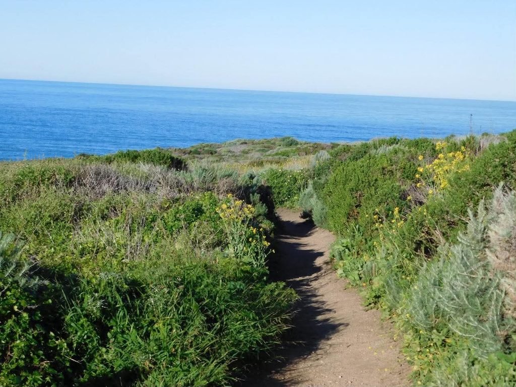
To get down to Garrapata State Beach, there is a set of stairs that takes you into the valley. There is a small stream and a plank that allows you to cross over and access the beach.
Unfortunately, the lilies had already started to wilt by the time I went, but their bloom time is roughly January through April.
It was still worth the stop because you get full access to the beach, and there was hardly anyone there so early in the morning.
The hike back up was probably the most daunting part of this trail, and I would highly suggest wearing more sensible shoes than I did.
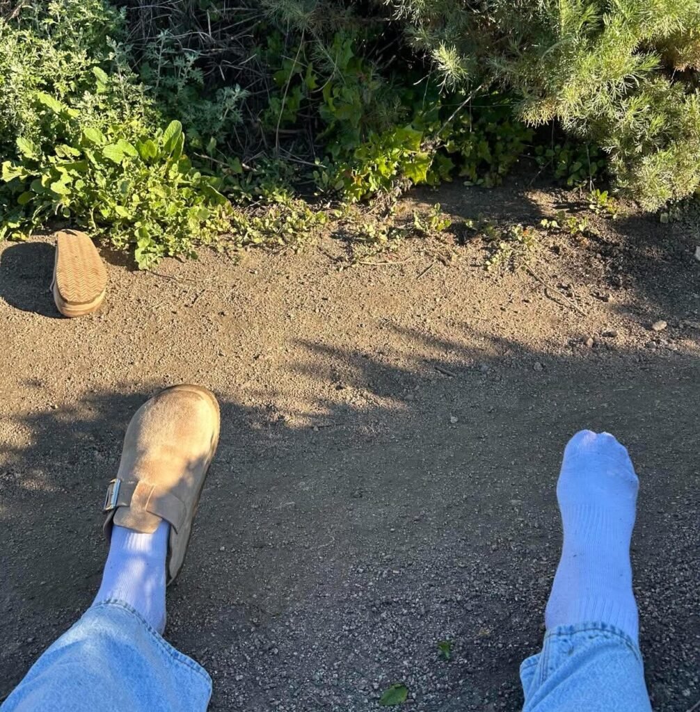
On the way back to the car, my platform Birkenstock dupe turned over, sending me straight into the bushes, and I definitely felt that for the rest of the day.
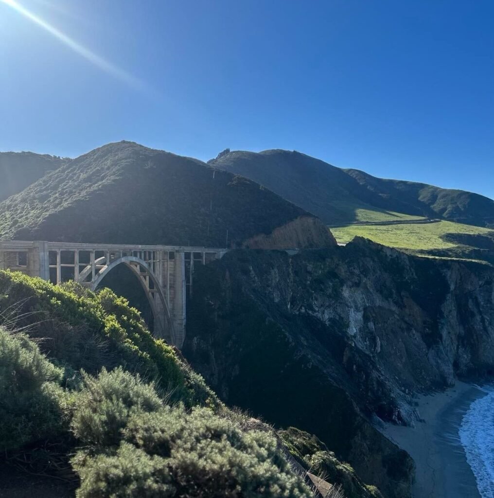
Another highlight of this drive, especially for a girl from Alabama, was the cows grazing in pastures overlooking the cliffs. You’ll start to see them more and more the closer you get to Bixby Bridge, which was my next stop.
Unfortunately, at quite literally the worst possible time, my camera died right as I arrived at the bridge. But I was still able to get some pictures on my phone, and a young couple took my picture in exchange for me taking theirs.
There were only about six people at the bridge around 8:45 a.m., and I would definitely recommend getting there early.
By the time I came back through later, with fresh camera batteries, I couldn’t stop because of the sheer amount of traffic and lack of available parking.
Once you cross the bridge and pass Point Sur Lighthouse and Andrew Molera State Park, Highway 1 starts to pull farther inland, and the scenery begins to change.
Surrounded by thick woods, I stopped at the first gas station and general store I came across, Big Sur River Inn and General Store, to pick up some batteries and a few more snacks.
The inn also has a country-style restaurant and chairs in the river that you can relax in. I would have loved to spend all of my morning there, and it is a must stop attraction for me when I go back.
About 15 minutes away, you will find Pfeiffer Big Sur State Park. The entry fee is $10 per vehicle, but the day pass is good for all California state parks.
This is where I saw the largest trees I’ve ever seen in my life and enjoyed a quiet walk along the Big Sur River.
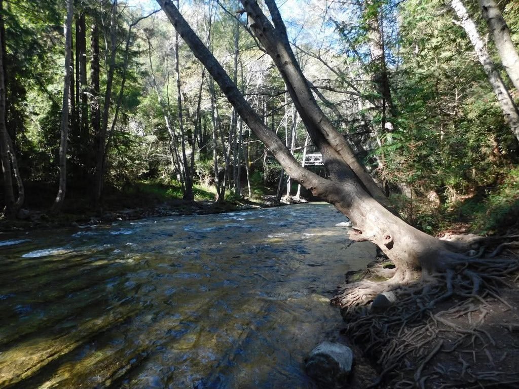
Approximately a half mile from the parking lot, there is a designated walking area where you can view some of the redwoods before crossing over into the campground. There is also an inn if camping is not your style.
The next stop was probably my favorite, but it is easy to miss if you aren’t paying attention. At this point, I had no service and was going completely off the audio tour.
Because there was so little signage, I would have absolutely driven right past it, even though I had specifically planned to stop here when I was researching the trip.
Which, in fact, is exactly what happened. I drove right by, but thankfully, the audio guide gives clear directions using the downloaded map and your phone’s satellite GPS.
Pfeiffer Beach is a must-do in Big Sur, but the drive down can turn some people away.
While paved, it is a narrow, one-way road that gave me a few heart palpitations. You’ll have to pull off for cars coming out, and RVs are not allowed.
Once you get to the entrance, you are required to pay $15. This confused me because I thought it would have been covered by the state park pass I had originally bought.
However, I was told that the entrance fee for Pfeiffer Beach is separate from the California State Parks pass.
Some highlights of the beach are the Keyhole Arch and its purple sand! In some spots, the sun hits the sand just right and reflects a purple tint.
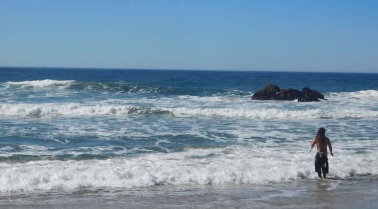
There is also a cove where many people were fishing and surfing. I had never seen someone surf in real life, so this was a highlight for me.
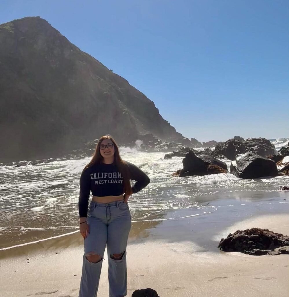
This was also the most crowded spot I had experienced so far that morning, with roughly thirty people on the beach. A man also climbed the arch, which was kind of insane and probably frowned upon.
Despite the number of people, I felt comfortable enough to set up my tripod and take some photos.
I spent the most time in Big Sur at this beach before heading to my turnaround point, McWay Falls in Julia Pfeiffer Burns State Park.
I actually didn’t make it all the way into the park, but I could have entered for free with the pass I had bought earlier.
McWay Falls is an 80-foot waterfall that drops right onto the beach below. To be clear, there is no beach access here, but you can still get beautiful views and photos from right off the road.
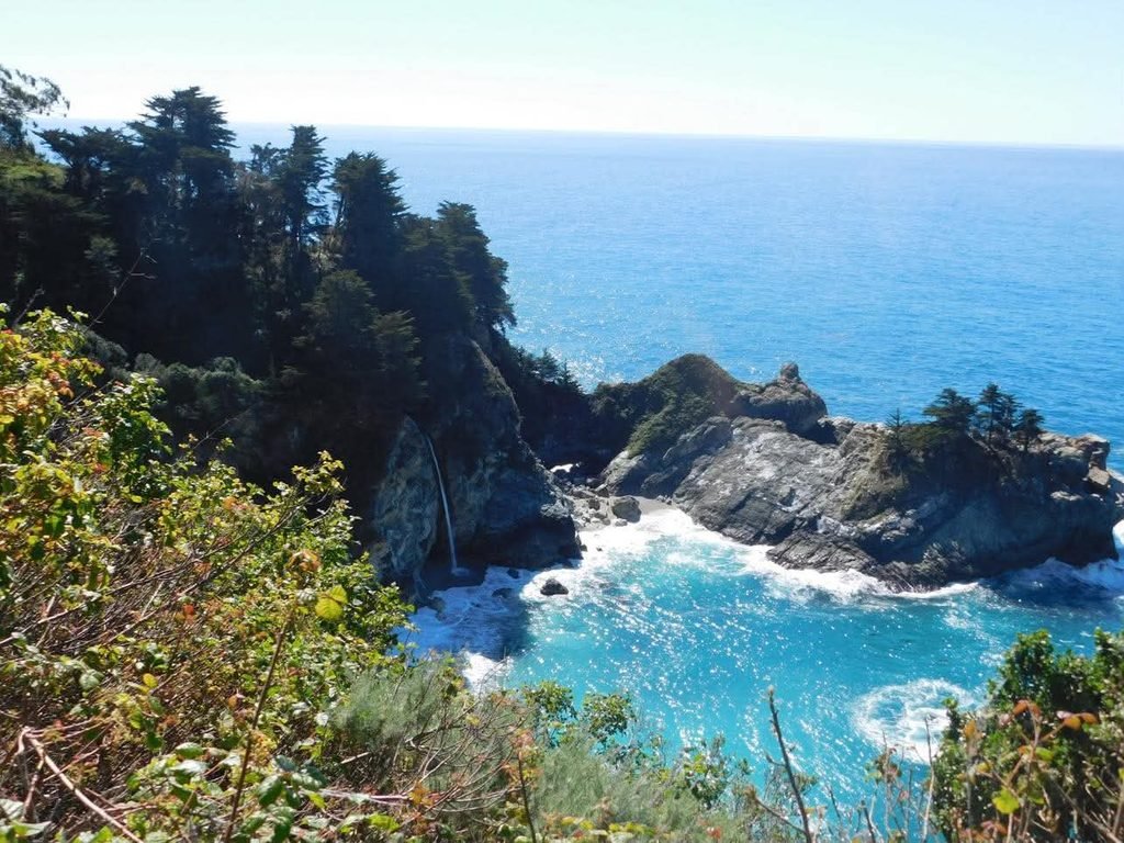
I stopped at a parking lot before the entrance, where I saw a woman painting the falls. I really enjoyed this because I had also seen her the day before painting the landscape of China Cove in Point Lobos.
It was such a small coincidence, but it made the trip feel a little more connected.
Still, I wanted some closer shots of McWay Falls, so I made my way toward the overlook to get a better view.
While I wasn’t rushing, I did have plans in San Jose that night, so I wanted to leave myself enough time to go back to the 17-Mile Drive, check out Carmel-by-the-Sea and Monterey Bay, and then make my way to my next hotel.
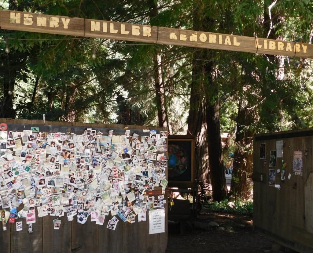
Before retracing my steps back toward Carmel, I made a pit stop at the Henry Miller Memorial Library, a nonprofit bookstore in the area.
As a bookworm, this place warmed my heart, and I felt like I had stepped into another world.
Inside, money from around the world hangs from the ceiling and art lines the walls. Outside, there are art pieces, “poet trees” where people have left their work, and books hang from branches.
My favorite part of this stop was the wall of Polaroid photos of past travelers, waiting to greet newcomers as they walked in from the parking lot.
There was something really special about seeing all of these people who had stopped here before me.
I also wanted to stop at Nepenthe, a nice restaurant with a terrace overlooking the coast, but I missed the turn and decided I would eat in Monterey. On my next visit, I would stop for the experience alone.
Traffic started to pick up significantly on my drive back around noon, and it made me glad that I had started my journey so early that morning.
Even then, I made it out of Big Sur in decent time, arriving in Carmel-by-the-Sea.
And, it was packed!
This turned me off a little since most of the downtown area seemed to be shopping, so I continued on to finish what I had started with the 17-Mile Drive.
If I had planned better, I would have done the full drive that Friday, but you live and learn.
That’s why I’m hear telling you my mistakes so you won’t make the same ones!
Anyway, I paid the $12.50 again and took my time along the route, stopping for deer roaming the roads and golf courses.
Pebble Beach, one of the most famous golf courses in the country, is located along the drive, and it was a cool experience to see people golfing throughout the route.
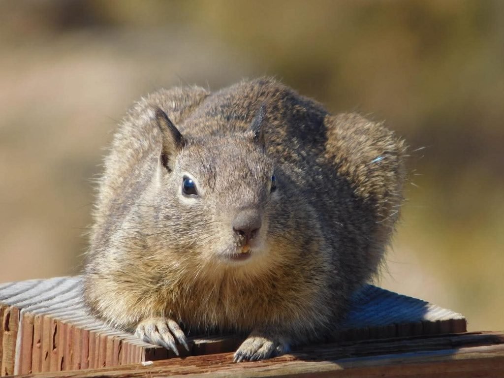
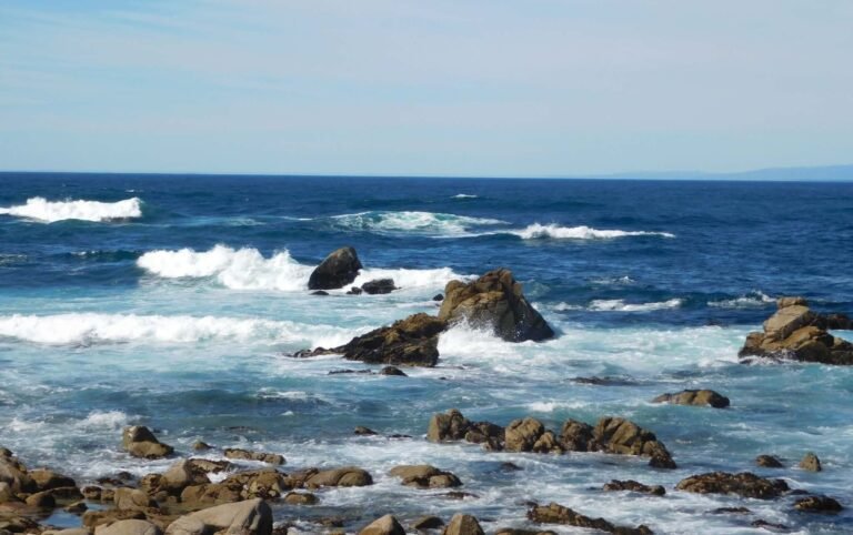
Some highlights of this drive was Seal Rock, Bird Rock, and China Rock. I saw so much wildlife on this drive, including a squirrel that let me give it a full photo shoot.
The 17-Mile Drive lets you out into Pacific Grove, which is a quick drive to Monterey Bay. I parked right on Cannery Row after a few circles around looking for an available spot.
I got really lucky to find one so close, but there are also parking garages and street parking a few blocks over. It is about $2 per hour to park on most streets during the daytime.
My main goal here was finding food quickly and somewhere on the water.
I get overwhelmed with too many options because I am pretty indecisive, so I looked around and just went with one of the more popular oceanfront restaurants, the Fish Hopper.
I’ve gotten used to eating by myself at this point, and I was more than thrilled when they took me outside to an individual table facing the ocean instead of seating me at the bar.
I had an amazing view and got to check something off my bucket list. I saw an otter floating out in the ocean, along with several sea lions passing by!
I also had clam chowder for the first time and immediately fell in love. This is what I would recommend getting here, because I did make a mistake with what I ordered as my entrée and immediately regretted it.
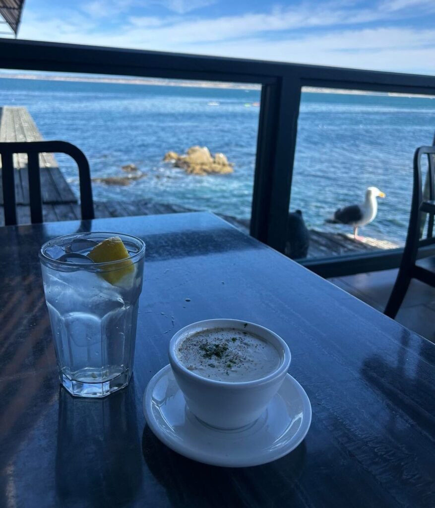
I splurged by going here anyway, but since I hadn’t eaten a real meal all day, I decided to get the Seafood Pasta Isabella.
I repeat, this was a mistake.
The dish was about $33, and I probably ate six bites before fishing the shrimp and clams out of it. I was highly disappointed and just wanted more chowder at that point.
I hit the road once I finished up with a late lunch around 3 p.m. and started my descent to San Jose, which takes about an hour and fifteen minutes.
I was extra pumped because I had scored a second-row seat to the Sharks game that night. All I wanted to do was get to the hotel and get ready for the 7 p.m. puck drop.
That night, I was staying at the Hampton Inn & Suites San Jose Airport, which cost me $110. I really like staying near an airport because I feel safer, and the prices tend to be better for me.
After checking in, I got ready and headed over to the SAP Center in downtown San Jose. I would have loved to have more time to really explore the city because the downtown area was such a vibe. It was also an area where I felt safe, especially as a woman walking the streets alone.
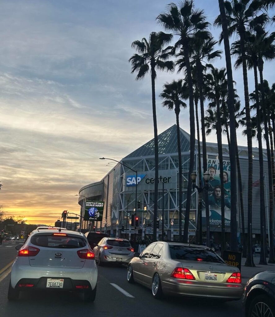
My parking was included when I bought my ticket, so I got a spot right across from the SAP Center. Other people at my hotel were Ubering to the game, which is also a good option, but I felt it would have been more expensive for me since I wasn’t sharing the ride with anyone.
The entry process was quick and easy, giving me enough time to go buy a Sharks hat and a drink before the game started.
The general public can also go down to the ice for pregame warm ups with their signs or to try and catch a puck from the players.
Since this was my first NHL game, I had no idea this was an option and ended up standing in the back for the entire warm up because people were filling the first four rows where my seat was.
It was a little awkward, which is why I’d suggest either getting there early to secure your spot or taking your time in the concourse if you have seats close to the ice.
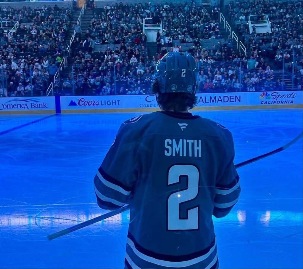
The game was a great time, and my seats were awesome. For the budget-friendly traveler, you can cut this expense altogether or take advantage of cheaper seats in other parts of the rink.
However, this was something that was really important to me, so I splurged big time.
I spent roughly $300 between the seat and parking, but the seat was in the second row, right next to the home bench. Totally worth it for me, and I had money set aside specifically for this.
After the game, I grabbed some food and settled in for the night. It had been another long day, and Sunday would be no different.
Day 3: San Jose to San Francisco
Sunday was largely unplanned for me. I knew I wanted to get into San Francisco and check out a vintage photo booth museum, but outside of that, I was going with the flow.
I woke up early once again and started the hour-long drive.
When I travel, I like to start at my furthest point at the beginning of the trip and then make my way back toward the city where my flight departs from, switching hotels along the way.
I’ve found this is much easier than having a home base and driving back and forth every day, especially since I try to see as many places as I can in one trip.
I made it to the Photo Booth Museum, Photomatica, around 10 a.m. and easily found parking right in front.
When I went, there were around four booths working, so I went back and forth trying them out. I probably spent around $50 here since the strips were $7 each.
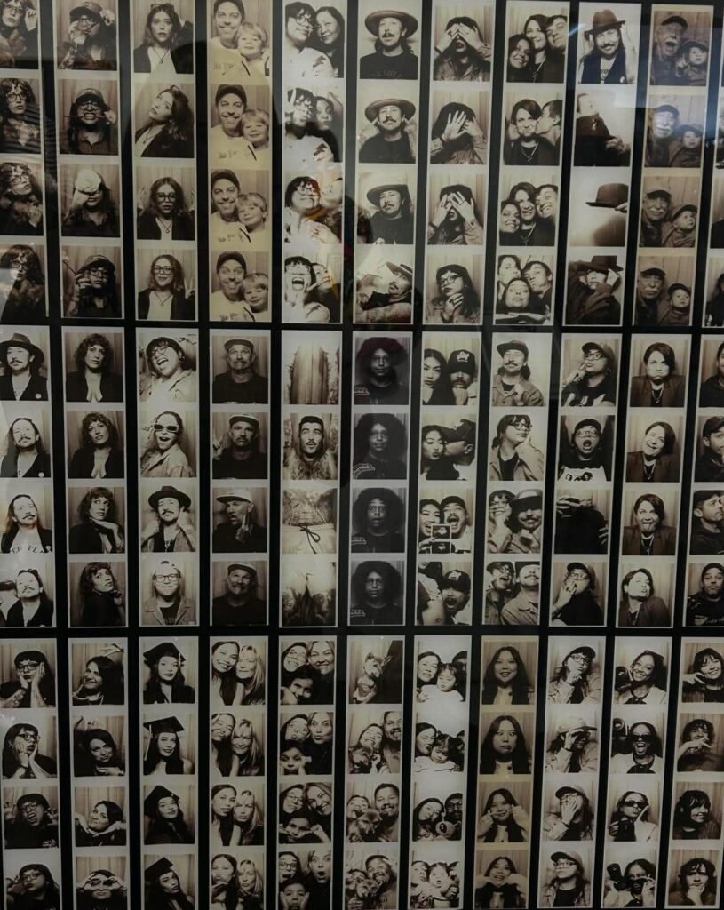
I spent more than I originally wanted because I didn’t love how some of the earlier ones came out. You could also turn your photos into key chains for an additional cost, but I had already spent a lot.
Pier 39 was about thirty minutes away, and it is such a staple of San Francisco that I thought I had to go. This was probably my least favorite part of the trip.
First, I had to pay $20 to park on the street, which automatically turned me off, but I thought I couldn’t miss out on this attraction.
I could have.
I learned fairly quickly that I was not having a good time.
This is also where I felt the most uncomfortable by myself, even though there were people everywhere.
The food was expensive and mediocre, and the whole area felt like a tourist trap. I may have enjoyed it more with other people, but as a solo female traveler, it just wasn’t for me.
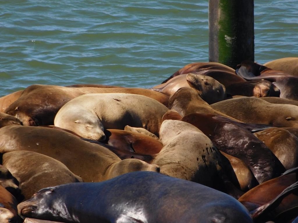
My only real highlight from this stop was the sea lions on the marina docks. The number of sea lions present depend on the time of year.
In March, there was one, maybe two, docks being used, but there are times where hundreds to thousands of sea lions hang out.
Once I got back to my car, I was overwhelmed and overstimulated. Cities aren’t really for me, and I knew I just wanted to get back out into nature.
So I started looking into places that I originally thought I wouldn’t have time for north of the city.
Muir Woods and Point Reyes came up as options, and I ultimately decided to go for the latter.
With some relief, I headed out of the city and eventually passed over the Golden Gate Bridge and got some pictures at the North Vista Point. This was a surreal experience for me, and I did tear up.
Coming from where I grew up, this was something I had only dreamed about as a kid, and it will forever be a memory I carry with me.
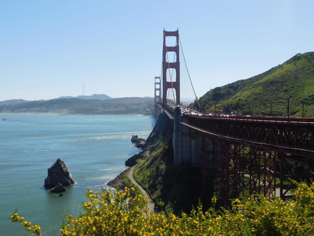
I think that is one of the best parts of solo travel. For me, it’s like healing a part of my inner child and proving to myself that I am brave and capable.
There is also a spiritual element to getting away from everyone else and simply being where my feet are. Whether you believe in God or not, I feel more connected to Him in these moments, and it fills my soul.
I’ve been on some really cool trips in my life, but my solo trips will always hold a special place in my heart because they’ve shown me that I don’t have to wait for other people.
I can experience the things I want without having to wait for someone else or feel like I have to diminish my own wants and experiences for the comfort of others. I can just be, however messy and unorganized that is.
Speaking of messy and unorganized, I did make another mistake.
Well, actually, my GPS made a mistake that actually turned into a really beautiful experience for me.
When I put in Point Reyes, it said it was about an hour and twenty minutes north. Amazing.
I went over the bridge, through Sausalito, past Muir Woods, and started the climb over Mount Tamalpais.
This was a little scary because the roads wind up and over the mountain with little to no guardrails. I would say if you are afraid of heights, this climb may give you pause, but to me, it was worth it.
I saw beautiful views that eventually opened up to the ocean. This turned into Stinson Beach, where my GPS said my destination was close.
Yeah, Point Reyes is nowhere near Stinson Beach. Like, 50 more minutes north, actually.
However, my GPS said I was there, but really I was just in Bolinas.
At this point, I was getting annoyed, and I was also a little sad because I only had two goals on this trip: see an otter and see a seal.
I had already made good on the first, but I still hadn’t found my seal.
Listen, I was literally talking to God, praying to see this seal. It was that serious to me. But, you know, I was also trying to let it be.
Frustrated but going with the flow, I made my way back to Stinson Beach, where I planned to chill for a little bit. I had done a lot of unplanned driving, and I was just over it.
On the way between Bolinas and Stinson Beach, there is an inlet connected to the bay called Bolinas Lagoon.
I hadn’t thought anything of it as I passed earlier, but now I briefly scanned the water with my last threads of hope.
And I saw three seals laying out in the shallow water. *Chills*
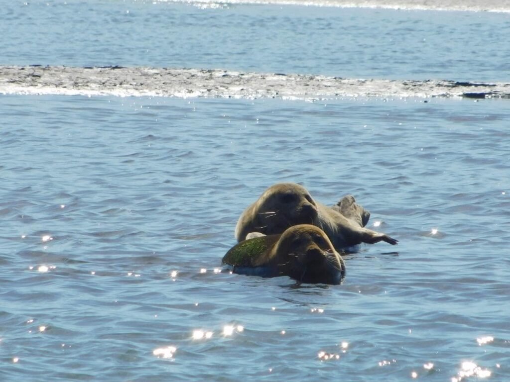
Back at Stinson Beach, people were everywhere, but it at least felt less overwhelming than being in the city. So I found a spot to sit for a while and watch people surf before eventually walking along the shoreline and taking it all in.
After some time at the beach, I headed back toward San Francisco to catch the sunset.
The spot I chose for this was Baker Beach, which has great views of the Golden Gate Bridge.
There is a parking lot, but it fills up quickly, so I chose free street parking on Lincoln Boulevard.
From there, you do have to walk pretty far down a dirt trail that was pretty secluded. While the sun was still out, I felt safe going down alone and even stopped for some quick photos. At dusk was a different story.
That trail lets out near the parking lot, and it’s a short walk across the sand to a good spot. There are also some logs to sit on, but I’d bring a chair or a blanket if you plan to hang out for a while.
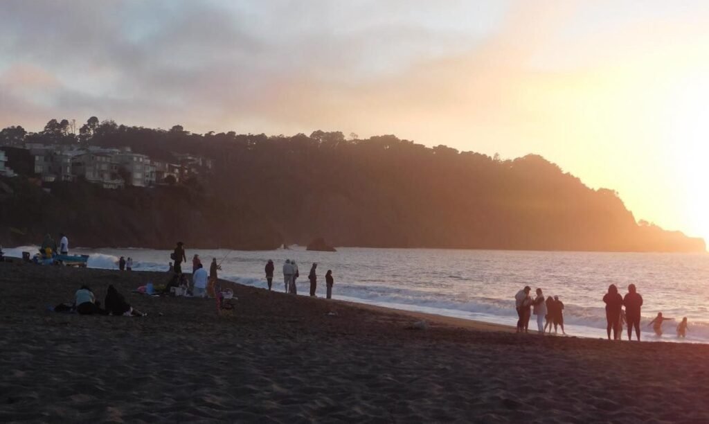
Most of the day had pleasant weather, but the wind really picked up at the beach. I can’t stress enough how vital a light jacket is at the very least.
I was literally freezing.
On the way back to the car, I did feel a little more uncomfortable because a man kept trying to walk and talk with me. Thankfully, he stopped along the trail at some point, and I was able to get to my car safely while staying vigilant. I did get catcalled while getting into the vehicle, though.
My next stop was the Hilton San Francisco Financial District. This was the most expensive stay of the trip at $170.
Also, if you have a car, their on-site parking is an additional $70, which I did not know beforehand and annoyed me greatly.
The only thing I really enjoyed about this stay was the view from my room, which overlooked Coit Tower.
To their credit, the hotel was clean, and I did feel safe inside.
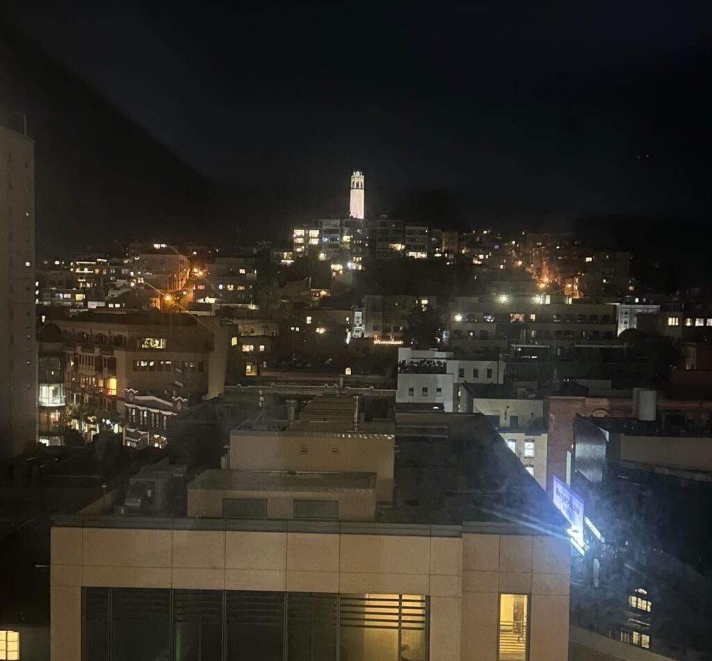
After settling into my hotel, I knew I needed food. I hadn’t ate since like 11:30 am and it was close to 8 pm. I also didn’t want to pay for more parking or an Uber for dinner, so I walked to North Beach.
I immediately regretted this decision because walking alone through Chinatown at night to get to North Beach creeped me all the way out.
It was a brief seven-to-ten-minute walk, but I decided that I would be Ubering back.
I did grab a Margherita pizza to go from Flour + Water before stopping at Lush Gelato. It was about 9 p.m. by then, and people were still lined up to get into the store. Thankfully, the line moved pretty quickly.
I had seen on TikTok that they had peach cobbler gelato, which was basically the reason I made the entire trip up to North Beach, but it was not an available flavor that night.
They have a lot of unique flavors that you can try before making a decision, and they’re all gluten-free as well. I’d suggest checking out their website or instagram before going since they post weekly what flavors are available.
I went with the crème fraîche and baked apple before calling my Uber and heading back to the hotel for the night.
Day 4: San Francisco to Austin
After three days of going nonstop, I decided to sleep in and have a chill morning before heading to the airport. Once I did get up, I went to the Painted Ladies and walked around the park for a bit.
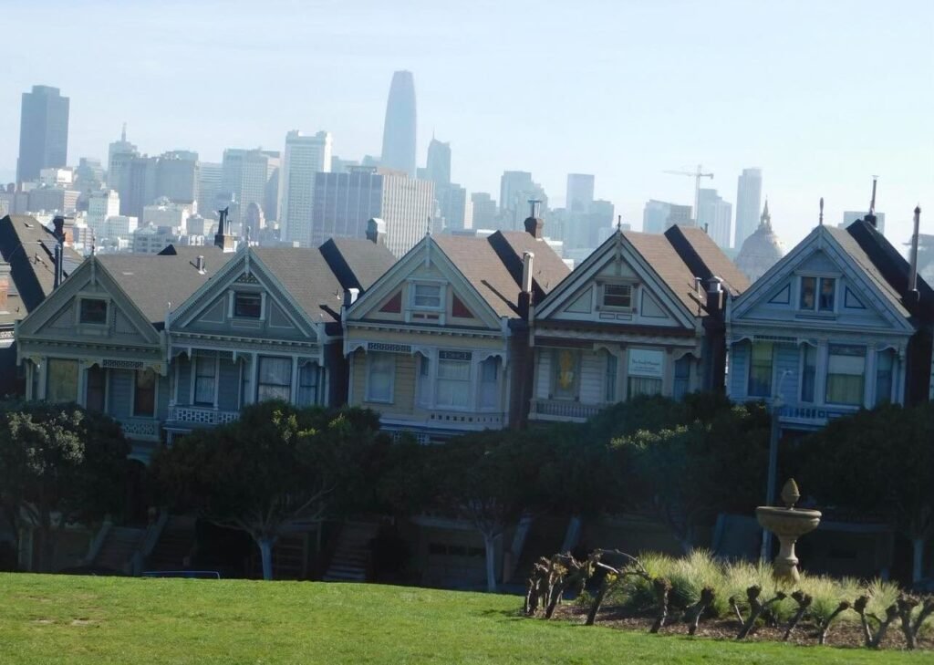
I knew I wanted to get some food before traveling home, and I always try to avoid eating at the airport. So I went to Super Duper Burger and had my last meal in San Francisco.
After that, I headed back toward the airport, filled up my rental car with gas to avoid an additional charge, turned in my car, and prepared for the four-hour flight home.
I departed around 3 p.m. and got back to Austin at 10:45 p.m. after another layover in Dallas Love Field. It felt much longer since we had to account for the two-hour time change from Pacific to Central time.
I then made the hour-and-forty-five-minute drive back to College Station with memories to keep for a lifetime.
What It Cost
In total, this trip cost me about $800 for all of the major logistics, including my flight, hotels, rental car, and gas. Once I added in food, entry fees, parking, and everything else, the total came out to about $1,000.
I’m not including the hockey ticket in that total because this was a completely optional splurge that could easily be avoided or cut down with cheaper seats.
I also saved for the ticket separately from my original travel budget, so it wasn’t something that took away from the rest of the trip.
I think you could reasonably do this trip for around $1,000, depending on your travel preferences.
I definitely found places where I could have spent less, but I also think it’s important to leave some room in your budget for the things that are worth it to you.
Is This a Good Solo Trip?
I would definitely recommend this trip if you’re looking to try solo travel. I really liked having the freedom to change my plans as I went.
There were plenty of times when I changed my mind, stopped somewhere I hadn’t planned on, or decided that something just wasn’t worth my time. Being alone made all of that really easy because I only had to worry about what I wanted to do.
The biggest thing I would say, though, is that you really need a car if you want to experience Big Sur. A lot of the places I wanted to see were spread out along Highway 1, and having my own car meant I could stop whenever I wanted, take a wrong turn or two, and change my plans without having to worry about anyone else. It also meant I could experience everything at my own pace.
If you don’t want to rent a car, I would probably spend more of your trip in San Francisco. There is plenty to do there, and you can get around without having to drive yourself everywhere. You could also look into a day trip if you want to get out of the city for a little while.
For me, though, having the car was completely worth it. Big Sur ended up being my favorite part of the trip, and I don’t think I would have enjoyed it nearly as much if I had been trying to rely on someone else to get me around.
So yes, I think this is a great solo trip. Just rent the car.
What I Learned
What made this trip so amazing wasn’t just the places I saw or the things I got to experience. It was also everything I learned about myself along the way.
I learned that I’m capable of navigating unfamiliar places on my own, making decisions as I go, changing my plans when things don’t work out, and still having an incredible time. More than anything, I learned that I don’t have to wait for someone else to experience the things I want to experience.
Unit next time,
Plus One Optional
One Comment